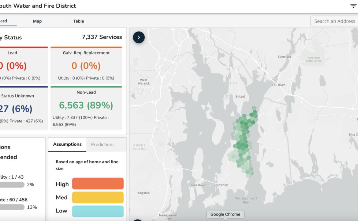
Hartford, VT: Lead Service Line Inventory and Replacement Plan
EPIC provided assistance to the Town of Hartford for developing and submitting both Quechee Central and Hartford Water systems’ lead service line (LSL) inventory and replacement plans to comply with the Lead and Copper Rule Revisions (LCRR).